As MEP Engineering, Inc. enters a new year of production, new projects are coming in fast and from all sectors of our industry. Our clients need quick turn-around and accuracy on every drawing we send out the door. To ensure our teams continue to exceed expectations, we’ve included advanced 3D Laser Scanner technology to our repertoire of services.
Our teams already utilize 3D Building Information Modeling (BIM) software to collaborate across disciplines and automate production of their designs. Implementing 3D Laser Scanning into our preliminary survey process was the logical next step to achieve seamless and accurate design.
How does it work?
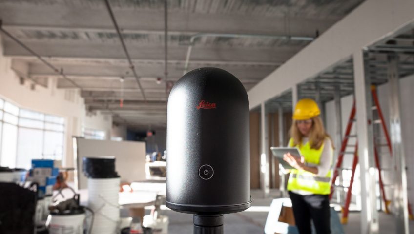
By definition, 3D Laser Scanning is the process of digitally capturing the shape of physical objects using a line of laser light. Our survey team places the scanner on a tripod to capture a 360-degree image of the surrounding area. The scanner then creates “point clouds” of data from the physical surface area of a room. This means we can capture the exact size and shape of every physical object in a room, then create a digital 3-dimensional representation that can be uploaded into a number of CAD, BIM, VR and AR applications.
MEP uses the Leica BLK360 Imaging Laser Scanner for all of our 3D Scanning needs. At roughly 2 pounds, the Leica BLK360 is the smallest and lightest imaging laser scanner available – making it easier for our survey personnel to bring along when surveying existing sites. Plus, it takes less than 3 minutes for a full-dome scan at 360,000 laser scan points per second, saving additional time and effort.
Why do we need it?
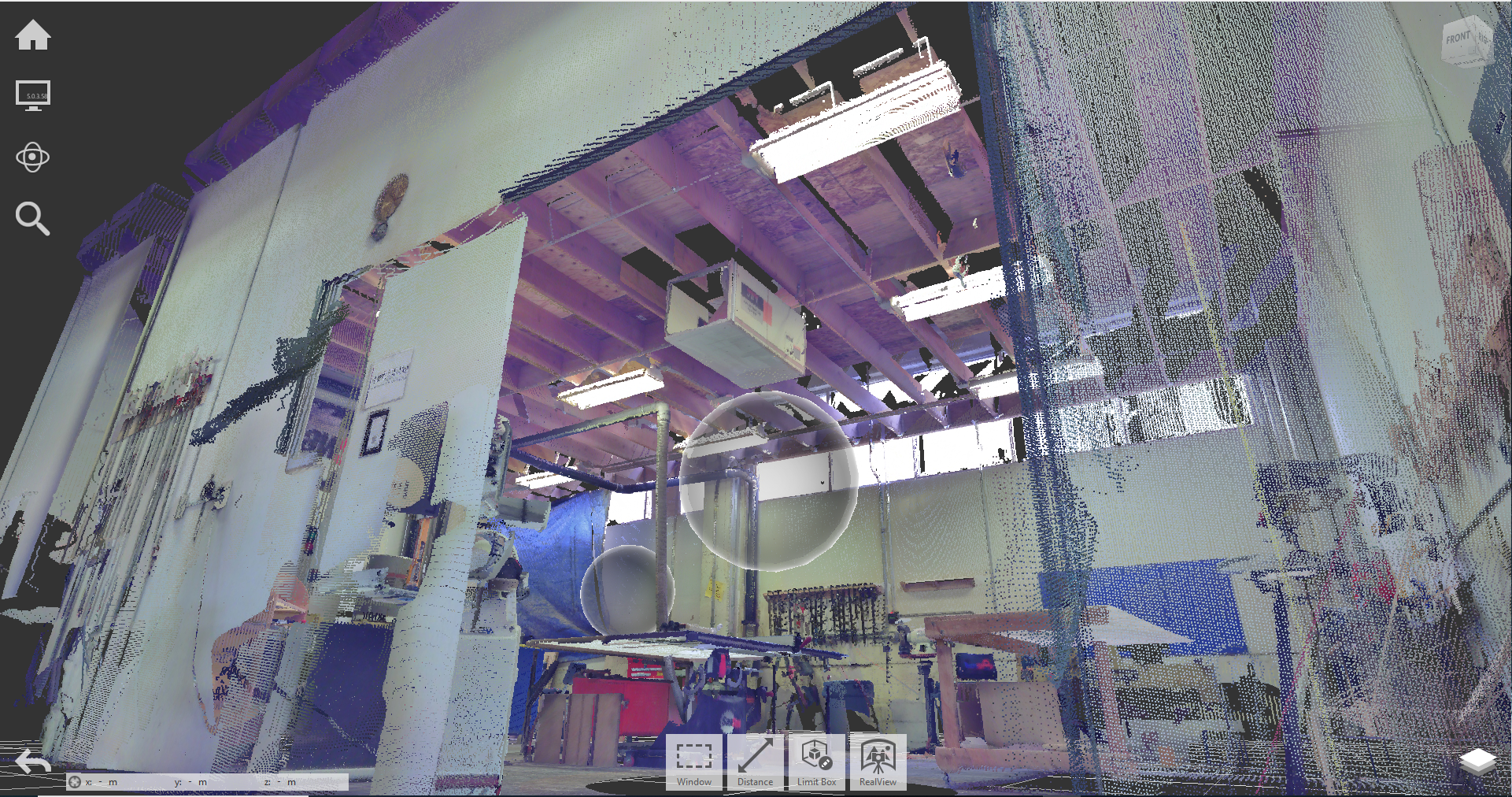
Laser scanning is the fastest, most accurate, and cost-effective way to acquire 3D digital data when surveying existing (and complex) building sites. The process has become easier than ever, with newer versions of Autodesk Revit and AutoCAD offering more realistic visualizations and 3D walk-throughs available from point clouds.
Rather than marking and measuring by hand, our surveyors press a single button that automatically stitches and registers exact dimensions and surface areas in ReCap Pro. Need to confirm mechanical equipment dimensions for a general contractor? Refer to the point cloud. Want to double-check exactly where an electrical distribution panel is located? Simply pull up a 360-degree view of the entire room.
Improving tech to maintain quality
At MEP Engineering, Inc., our clients’ needs are consistently a top priority. We actively research and investigate new technologies that can improve our services and help exceed our clients’ expectations. 3D Laser Scanning is a stepping stone to greater advancements in MEP systems design – we are taking that step to maintain the quality, accuracy, and timeliness of all of our services.